Join Darlene Liss, volunteer Forest Ambassador, on Wednesdays at the Maroon Bells Visitor Center for hands-on exploration
of wild things.

Take the Forest Conservancy Conservation Pledge to earn a Smokey Bear Junior Ranger pin.

 
DO YOU LIKE TO SHOP?
Click here to find out how you can support
the Forest Conservancy while you shop!
about us   |   volunteering   |   find a trail   |   e-naturalist cafe   |   quick links
Columbines
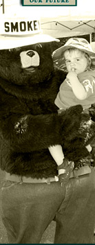
Smokey Bear educates the public about preventing forest fires.
LEAD KING BASIN LOOP ROAD #315 & #314
Back to the trails list

 
Trail: Lead King Basin Loop Road #315 & #314
Region: Crystal River Valley
Difficulty: difficult
Description: This road passes very close to the boundary of the Maroon Bells-Snowmass Wilderness and affords some spectacular views of mountains, meadows and canyons. Lead King Basin is covered with a great variety of flowers throughout the Summer. The majority of the flowers are usually in bloom in August, and the show is quite colorful and impressive. There are three trailheads into the Maroon Bells-Snowmass Wilderness located along this road. Use caution when driving the old bridge over the Crystal River between Crystal and Lead King Basin (it is located on private land). The famous, historical Crystal Mill is located along this road and offers great photo opportunities along the Crystal River. The segment from Marble along #315 to Lead King Basin should not be travelled when it is wet! The road is built on slick shale and slopes towards the valley bottom. 4WD is required. From Lead King to Crystal City the road is very narrow and extremely rocky. There is a very steep drop-off into the Crystal River Canyon. There are few pull-offs on this road and drivers may be required to back-up for considerable distances when another vehicle is met. A high clearance 4WD vehicle is required for this segment.
Directions: From Carbondale travel south on Colorado Highway 133 for 22 miles to the Marble turn-off and veer left. Go east on the Marble road #314, pass through Marble, and drive past Beaver Lake. The 4WD section begins just past the Gold Pan Gallery. The road begins to head uphill and passes over shale rock. About 1 mile outside of Marble there is a fork in the road; take the left fork onto road #315. This road immediately heads uphill. After about 8 miles, road #315 loops into road #314 at Crystal City. To continue the loop drive, stay on #314 for approximately 5 miles back to Marble.
Map: Marble, Snowmass Mountain


Home  |   About Us  |   Volunteering  |   E-Naturalist Café  |   Support the Forest Conservancy  |   Contact Us  |   Site Map
THE FOREST CONSERVANCY • 1012 Brookie Drive, Carbondale, CO 81623 • 970-963-8071

Site Design by: Unleashed Designs